If you have a webcam (most laptops and mobile devices do and you can buy one for a desktop computer for under £10) you can incorporate QR codes into learning.
What is a QR code?
What is a QR code?
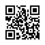
A QR code is similar to a bar code and a QR reader or barcode scanner can read the information included in it. QR codes can be printed ready to be scanned and the results can link to an image or a website. When the student (or member of the audience for the bar code) scans the code they are automatically taken to this information.
There are many ways to use QR codes. Here are a couple we have used:
1. Place QR codes around the building linking to information on websites (set up in advance). As the students explore the physical environment they find the QR codes in a kind of treasure hunt and gather information they need about a topic.
2. In an enquiry based around the River Tyne students produced a variety of material to present what they had found in their enquiries. This included videos, images, music, presentations, websites, animations - bascially they had free reign to present their information. The information was all collected into one place online and we then produced QR codes to place in keyrings and placed these keyrings along the River Tyne. This gave our students a really authentic audience as any member of public coming across the QR code with a mobile device can scan the code and will be taken directly to the students' work about the River Tyne.
The video below is aimed at Businesses but is a good overview of QR codes and how to create one: